|
Just Our
Pictures of New Zealand
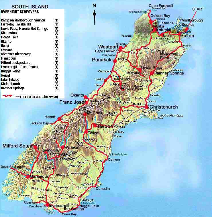
South Island Map Hearsay has it, that if the New Zealand terrain was ironed flat, it would cover a similar land area to Australia; it takes more time to explore and appreciate than looks obvious. The 27 days we had to 'do' the South Island were never going to be enough. The plan was to allow ourselves the flexibility to stay longer than a day in any given place, so as to have freedom to explore the natural features where they demanded. Ahem. That was most everywhere. We chose to ferry our car across Cook Strait and drive the Island in an anti clockwise direction. Because the island is long and narrow with an alpine range in its middle, this worked well. We were able to follow the coast and divert from our circuit to points of interest. The route we chose had impact value also; the contrast in terrain between the coast and the interior, was startling. What didn't work well was, when day 20 arrived we had made it to Milford only. We still wanted to cover the deep south, the eastern coast and the central alpine area, plus spend longer where we were! No matter what time we'd had, we'd have filled it.
Please enjoy browsing our pictures of the South Island of New Zealand |